
Supercharge Your STAC Catalog
The hardest part of EO isn't analysis - it's moving the data. Stream images 11x faster to your GPU.
from rasteret import Rasteret, ChipTiler
from torch.utils.data import DataLoader

client = Rasteret(api_key="...")

# Stream directly to PyTorch - no downloads
for chip in ChipTiler(client,
                      geometry=my_aoi,
                      dataset="my-org-stac/dataset-name",
                      bands=["red", "nir"]):
prediction = model(chip.to_torch()) from rasteret import Rasteret, ChipTiler
from torch.utils.data import DataLoader
client = Rasteret(api_key="...")
# Stream directly to PyTorch - no downloads
for chip in ChipTiler(client,
geometry=my_aoi,
dataset="my-org-stac/dataset-name",
bands=["red", "nir"]):
prediction = model(chip.to_torch()) Powered by Rasteret
The fastest satellite image processing library. Read satellite images 11x faster than traditional tools.
Performance Comparison
Stream Any Dataset. Yours or Ours.
Public data to get started. Connect your own S3 for private streaming.
Sentinel-2 Level-2A Surface Reflectance
Copernicus Sentinel-2 L2A
Copernicus Sentinel-2 Level-2A provides atmospherically corrected surface reflectance imagery across 13 spectral bands. The dataset covers all land surfaces between 84°N and 56°S, with a 5-day revisit time at the equator. Level-2A processing includes Scene Classification (SCL), Aerosol Optical Thickness (AOT), and Water Vapor (WVP) products.

USGS Landsat Collection 2 Level-2 Surface Reflectance
USGS Landsat Collection 2
Landsat Collection 2 Level-2 Surface Reflectance provides the longest continuous space-based record of Earth's land, spanning from 1982 to present across Landsat missions 4, 5, 7, 8, and 9. Surface reflectance data is atmospherically corrected and includes quality assessment bands for clouds, shadows, snow, and saturation.
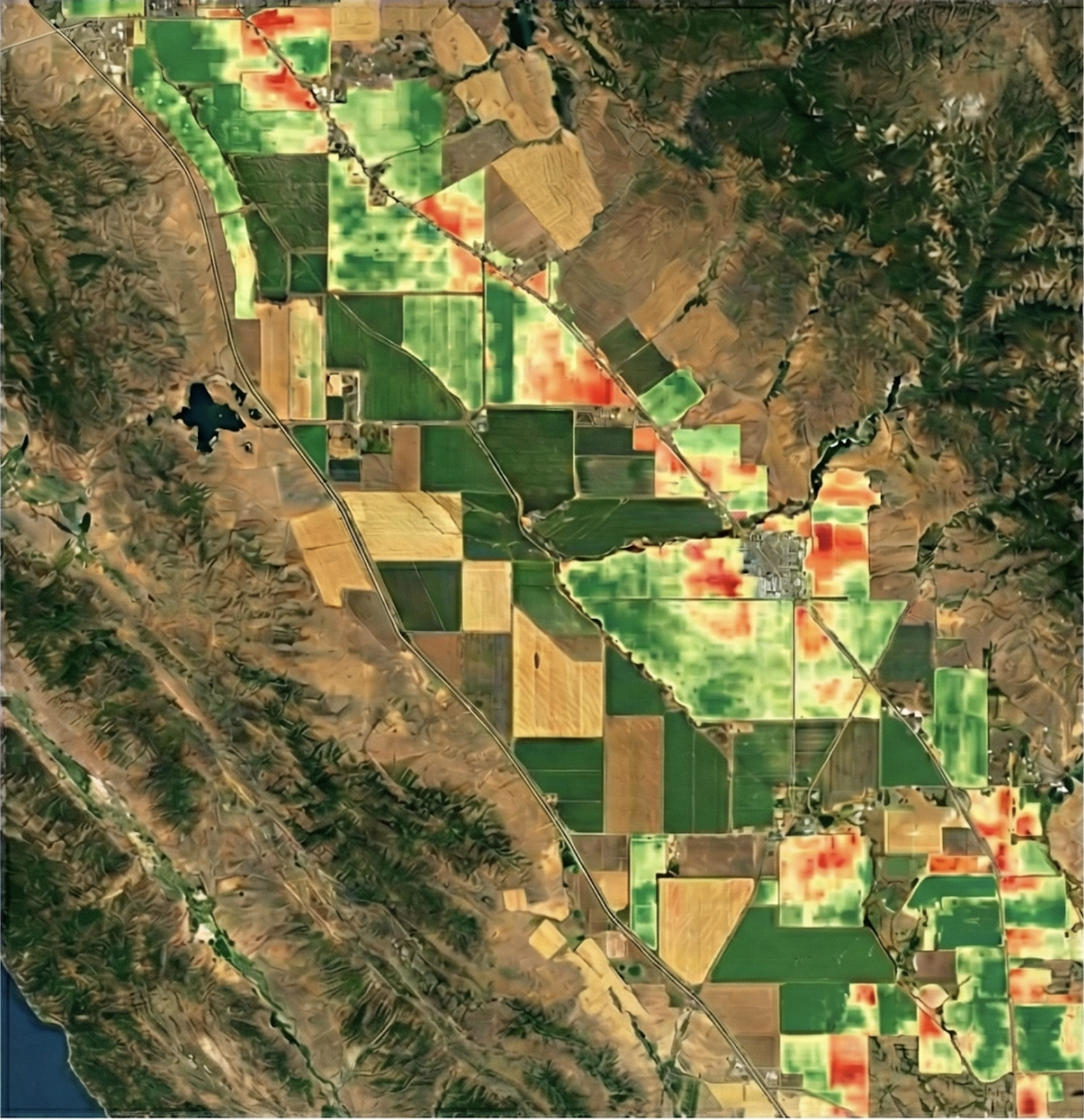
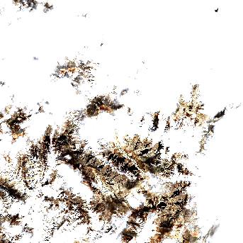
California Crop Yield Analysis 2024
My Organization (Internal)
High-resolution NDVI time-series analysis for Central Valley agricultural zones. Derived from Sentinel-2 L2A for Q3 yield prediction models.
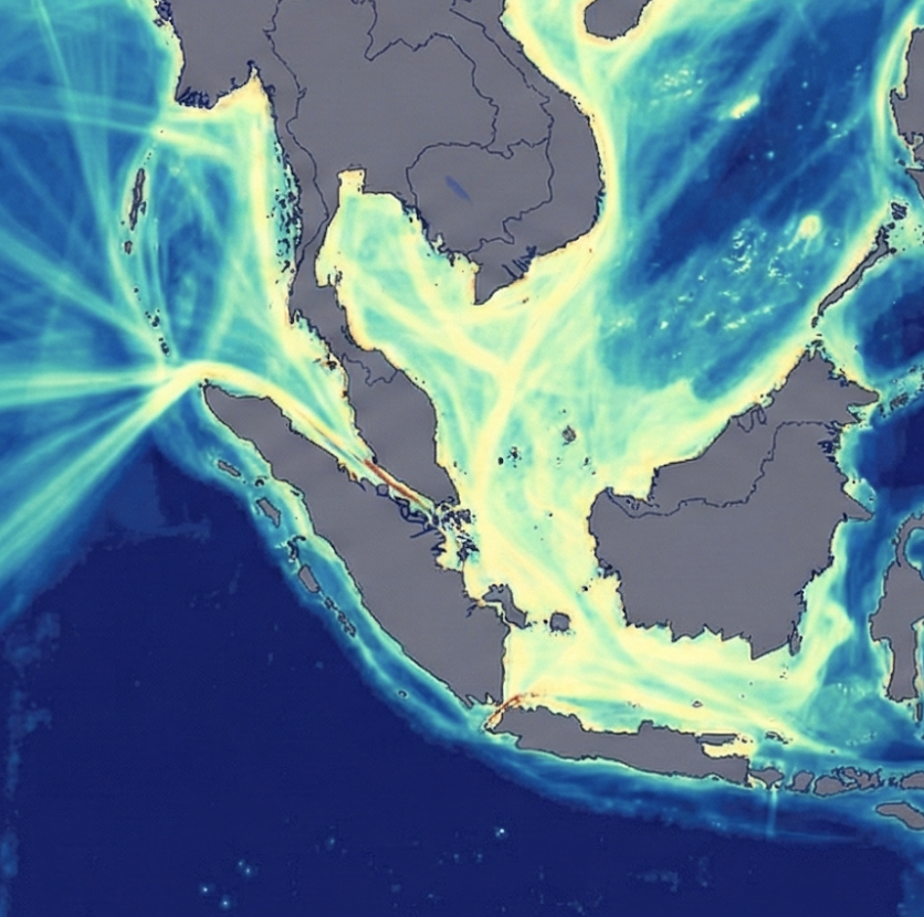
Southeast Asia Ship Detection
My Organization (Published)
AI-derived vessel detection heatmap for major shipping lanes. Updated daily via automated pipeline. Benchmark dataset for maritime logistics.
No More Ceremonies To Get Data
Why build a 15-step pipeline for a simple read? Terrafloww collapses the stack. From import to data in 3 steps.
from rasteret import Rasteret
from torch.utils.data import DataLoader

client = Rasteret(api_key="...")

# Stream directly to PyTorch DataLoader
dataset = client.to_torch_dataset(
    geometry=my_aoi,
    bands=["red", "nir", "visual"],
    date_range=("2024-01-01", "2024-01-31"),
    dataset="my-org-stac/dataset-name",
    chip_size=256
)

loader = DataLoader(dataset, batch_size=32, num_workers=4)

# Train directly - no downloads, no ETL
for batch in loader:
    predictions = model(batch)
No Downloads
Stream data directly from cloud storage
No Memory Errors
Process petabytes without RAM limits
No Boilerplate
Focus on analysis, not infrastructure
Cloud-Native Architecture
Built on open standards. Designed for scale. Ready for production.
Discover
Connect to public archives or your own S3 buckets
Stream using Rasteret
Fast data streaming directly to your compute environment
Analyze
Simple Python SDK that feels like local data - but planetary scale